Given the region’s high vulnerability to natural and technological hazards, the need for smart tools and technologies to support regional preparedness and response for disasters remains a key priority for the Caribbean Disaster Emergency Management Agency (CDEMA) and its partners.
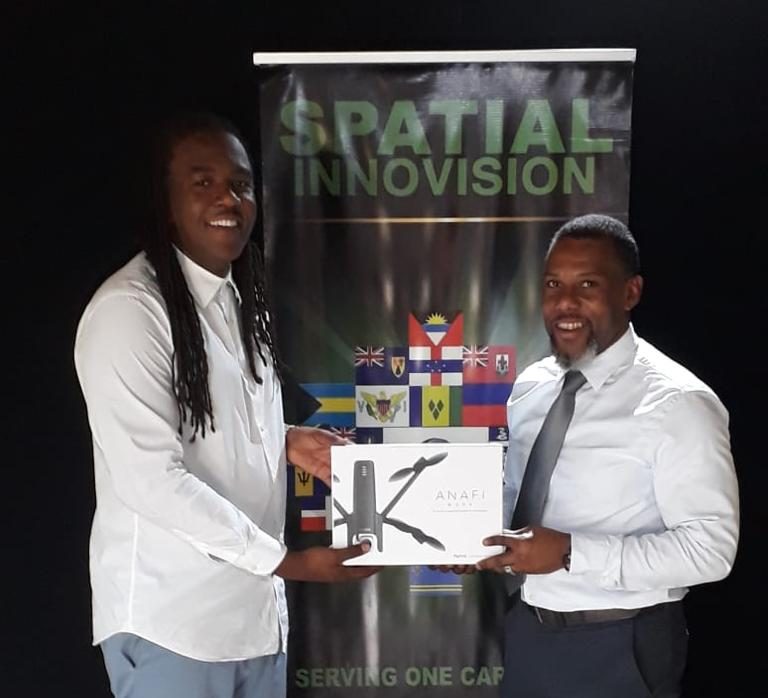
In response to this critical need, Spatial Innovision Limited, the Caribbean’s leading geospatial solutions and mapping company, recently contributed a state-of-the-art Parrot Anafi Work unmanned aerial drone, associated software and technical support, to enhance the work of CDEMA. T
he donation was made to CDEMA’s Executive Director, Ronald Jackson at the head office of Spatial Innovision, in Kingston Jamaica.
At the hand-over event, Jackson thanked Spatial Innovision and added that, “You can count on the fact that this will certainly be utilized in our operations as we seek to expand our mapping of information to better prepare for disasters.”
In making the presentation Roshaun Clarke, Deputy CEO remarked that, “For Spatial Innovision, this is a way to contribute to the region by arming CDEMA with some of the tools needed to better prepare before a disaster and to map the extent of damages after one”.
CDEMA has responsibility for mobilizing and coordinating disaster relief and is one of the first agencies on the ground as disaster strikes. Drones, therefore, are critical to assessing damages as well as mapping the recovery progress.
The Spatial team walked Jackson through the details of the Anafi drone, the accompanying software and ended the presentation ceremony with a quick demo flight on the grounds of the Spatial offices.
Spatial Innovision offers geospatial solutions to the Caribbean, combining leading technologies from its best-of-class international partners with the high level expertise of its staff members. The company has offices in Kingston, Jamaica and Port of Spain, Trinidad and Tobago.