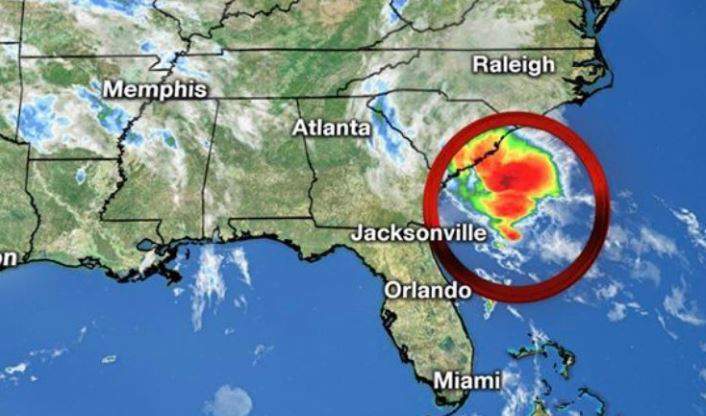
Tropical Storm Bertha has formed off the coast of the Carolinas.
A Tropical Storm Warning is in effect for Edisto Beach to South Santee River. A Tropical Storm Warning means that tropical storm conditions are expected somewhere within the warning, in this case in the next few hours.
A Flash Flood Watch has also been issued for the entire WMBF viewing area, according to the National Weather Service in Wilmington, N.C. It includes the following areas: Central Horry, Coastal Georgetown, Coastal Horry, Darlington, Dillon, Florence, Inland Georgetown, Marion, Marlboro, Northern Horry, and Williamsburg. It is in effect until late Wednesday night and there is a potential for 1 to 3 inches of rainfall, with isolated 4-inch amounts possible.
At 8:30 AM EDT (1230 UTC), the center of Tropical Storm Bertha was located near latitude 32.7 North, longitude 79.4 West. Bertha is moving toward the northwest near 9 mph (15 km/h) and this motion is expected to continue through tonight. On the forecast track the center of Bertha will move onshore in the warning area in the next few hours and the move inland across eastern and northern South Carolina later today and into west-central North Carolina by tonight.
Maximum sustained winds are near 45 mph (75 km/h) with higher gusts. Bertha is expected to weaken to a tropical depression after moving inland and become a remnant low tonight.
Tropical-storm-force winds extend outward up to 25 miles (35 km) from the center.
The estimated minimum central pressure is 1009 mb (29.80 inches).
RAINFALL: Bertha is expected to produce total rain accumulation of 2 to 4 inches with isolated totals of 8 inches across eastern and central South Carolina into west central to far southeastern North Carolina and southwest Virginia. This rainfall may produce life-threatening flash flooding.
WIND: Tropical storm conditions are expected to reach the coast within the warning area in the next couple of hours.